
Description
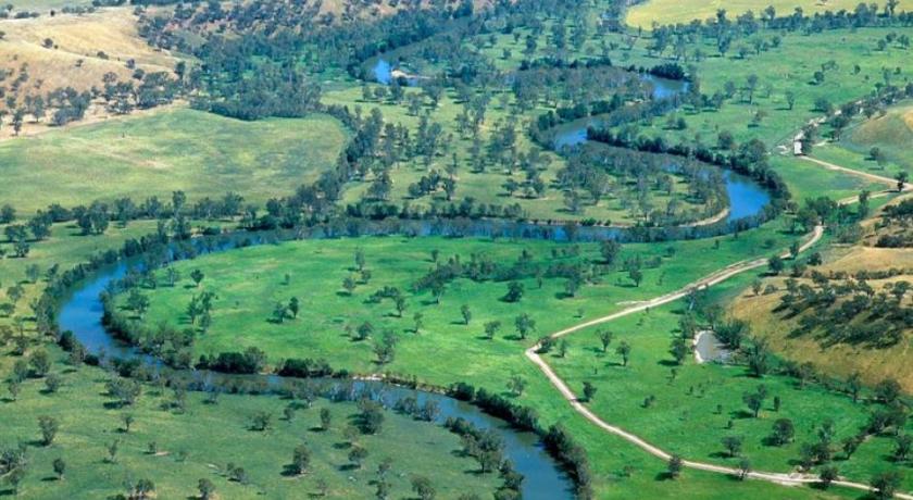
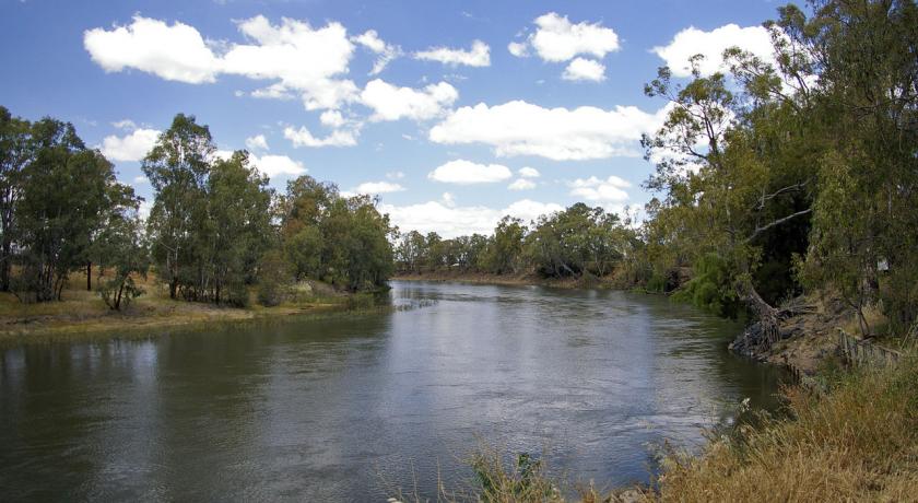
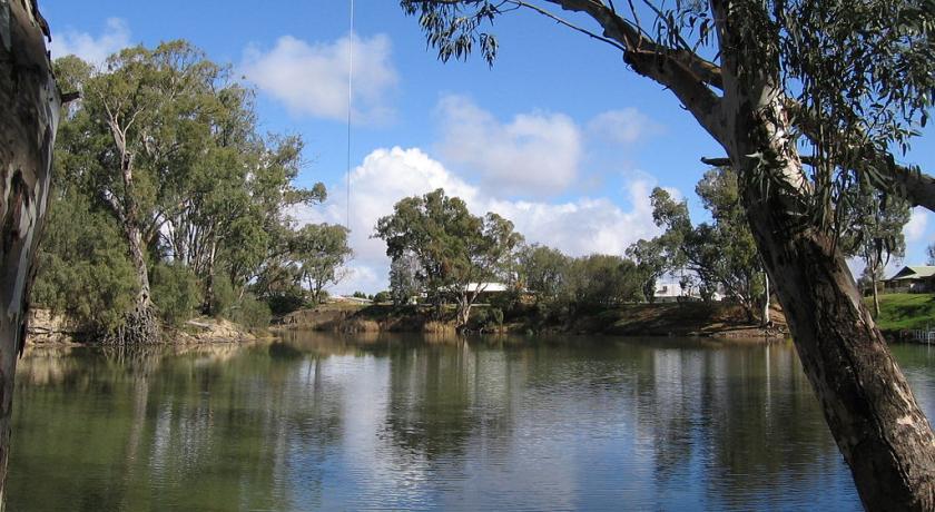
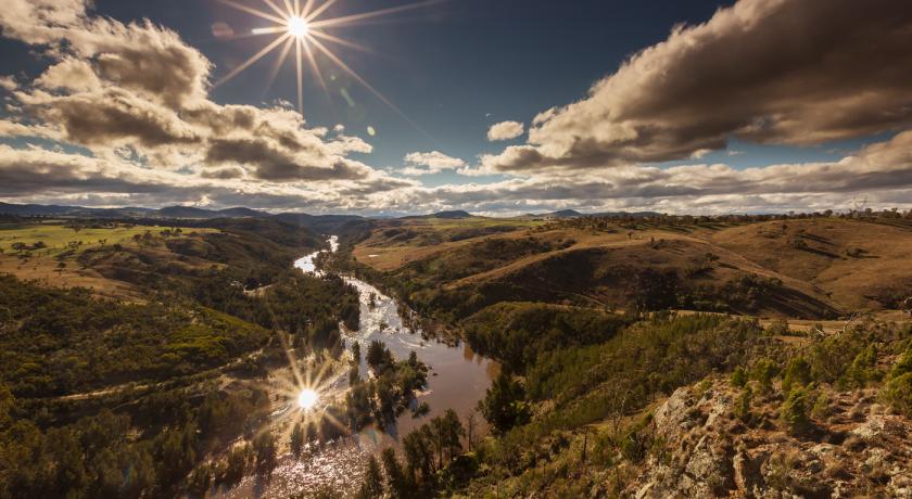
Murrumbidgee River (), a major tributary of the Murray River within the Murray–Darling basin and the second longest river in Australia. It flows through the Australian state of New South Wales and the Australian Capital Territory. It descends 1,500 metres (4,900 ft) as it flows 1,485 kilometres (923 mi) in a west-northwesterly direction from the foot of Peppercorn Hill in the Fiery Range of the Snowy Mountains towards its confluence with the Murray River near Boundary Bend.
The word Murrumbidgee means "big water" in the Wiradjuri language, one of the local Aboriginal languages. The river itself flows through several traditional Indigenous Australian lands, home to various Aboriginal tribes. In the Australian Capital Territory, the river is bordered by a narrow strip of land on each side, which are both managed as the ‘Murrumbidgee River Corridor’ (MRC). This land includes nature reserves, eight recreation reserves, a European heritage conservation zone and rural leases.
Flow
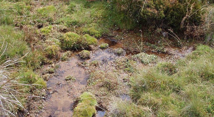
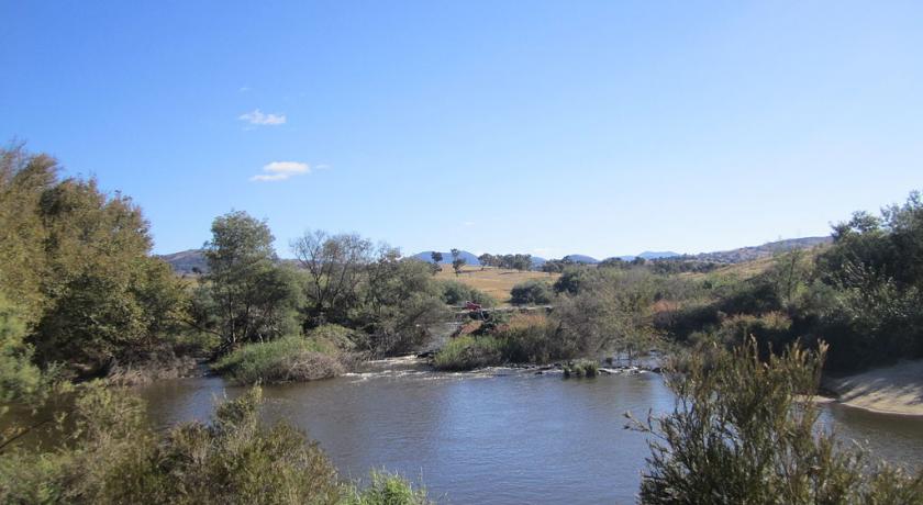
The mainstream of the river system flows for 900 kilometres (560 mi). The river's headwaters arise from the wet heath and bog at the foot of Peppercorn Hill situated along Long Plain which is within the Fiery Range of the Snowy Mountains; and about 50 kilometres (31 mi) north of Kiandra. From its headwaters it flows to its confluence with the Murray River. The river flows for 66 kilometres (41 mi) through the Australian Capital Territory near Canberra, picking up the important tributaries of the Gudgenby, Queanbeyan, Molonglo and Cotter Rivers. The Murrumbidgee drains much of southern New South Wales and all of the Australian Capital Territory, and is an important source of irrigation water for the Riverina farming area.
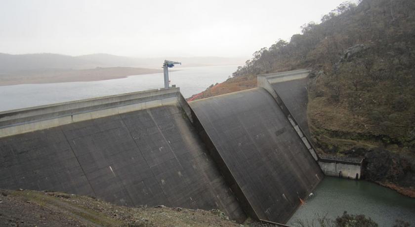
The reaches of the Murrumbidgee in the Australian Capital Territory (ACT) are affected by the complete elimination of large spring snow melt flows and a reduction of average annual flows of almost 50%, due to Tantangara Dam. Tantangara Dam was completed in 1960 on the headwaters of Murrumbidgee River and diverts approximately 99% of the river's flow at that point into Lake Eucumbene. This has extremely serious effects on native fish populations and other native aquatic life and has led to serious siltation, stream contraction, fish habitat loss and other problems. The Murrumbidgee where it enters the ACT is effectively half the river it used to be.
A study suggests a section of the upper river's channels are relatively new in geological terms, dating from the early Miocene (the Miocene era being from 23 to 5 million years ago). It is suggested that the Upper Murrumbidgee is an anabranch of the Tumut River (that once continued north along Mutta Mutta Creek) when geological uplift near Adaminaby diverted its flow. From Gundagai onwards the rivers flow within its ancestral channel.
In June 2008 the Murray-Darling Basin Commission released a report on the condition of the Murray-Darling basin, with the Goulburn and Murrumbidgee Rivers rated in a very poor condition in the Murray-Darling basin with fish stocks in both rivers were also rated as extremely poor, with only 13 of the original 22 native fish species still found in the Murrumbidgee River.
History
The Murrumbidgee River runs through the traditional lands of the Ngarigo, Ngunnawal, Wiradjuri, Nari Nari and Muthi Muthi Aboriginal tribes.
Exploration
The Murrumbidgee River was known to Europeans before it was actually discovered by them. In 1820 the explorer Charles Throsby informed the Governor of New South Wales that he anticipated finding "a considerable river of salt water (except at very wet seasons), called by the natives Mur-rum-big-gee". In the expedition journal, Throsby wrote as a marginal note: "This river or stream is called by the natives Yeal-am-bid-gie ...". The river he had stumbled upon was in fact the Molonglo River, Throsby reached the actual river in April 1821.
In 1823, Brigade-Major John Ovens and Captain Mark Currie reached the upper Murrumbidgee when exploring south of Lake George. In 1829, Charles Sturt and his party rowed down the lower half of the Murrumbidgee River in a stoutly built, large row-boat, from Narrandera to the Murray River, and then down the Murray River to the sea. They then rowed back upstream, against the current, to their starting point. Sturt's description of their passage through the junction of the Murrumbidgee and Murray Rivers is dramatic. His description of wild strong currents in the Murrumbidgee—in the middle of summer (14 January 1830), when flows are declining and close to the seasonal summer/autumn minimum, are in contrast to the sluggish, chronically irrigation-reduced flow seen at the junction today in mid-summer:
The men looked anxiously out ahead; for the singular change in the river had impressed on them an idea, that we were approaching its termination ... We were carried at a fearful rate down its gloomy and contracted banks ... At 3 p.m., Hopkinson called out that we were approaching a junction, and in less than a minute afterwards, we were hurried into a broad and noble river ... such was the force with which we had been shot out of the Morumbidgee, that we were carried nearly to the bank opposite its embouchure, whilst we continued to gaze in silent astonishment on the capacious channel [of the Murray River] we had entered ...
The Murrumbidgee basin was opened to settlement in the 1830s and soon became an important farming area.
Ernest Favenc, when writing on Australian exploration, commented on the relatively tardy European discovery of the river and that the river retained a name used by Indigenous Australians:
Here we may remark on the tenacity with which the Murrumbidgee River long eluded the eye of the white man. It is scarcely probable that Meehan and Hume, who on this occasion were within comparatively easy reach of the head waters, could have seen a new inland river at that time without mentioning the fact, but there is no record traceable anywhere as to the date of its discovery, or the name of its finder. When in 1823 Captain Currie and Major Ovens were led along its bank on to the beautiful Maneroo country by Joseph Wild, the stream was then familiar to the early settlers and called the Morumbidgee. Even in 1821, when Hume found the Yass Plains, almost on its bank, he makes no special mention of the river. From all this we may deduce the extremely probable fact that the position of the river was shown to some stockrider by a native, who also confided the aboriginal name, and so it gradually worked the knowledge of its identity into general belief. This theory is the more feasible as the river has retained its native name. If a white man of any known position had made the discovery, it would at once have received the name of some person holding official sway.
Floods
The river has risen above 7 metres (23 ft) at Gundagai nine times between 1852 and 2010, an average of just under once every eleven years. Since 1925, flooding has been minor with the exception of floods in 1974 and in December 2010, when the river rose to 10.2 metres (33 ft) at Gundagai. In the 1852 disaster, the river rose to just over 12.2 m (40 ft). The following year the river again rose to just over 12.5 m (41 ft). The construction of Burrinjuck Dam from 1907 has significantly reduced flooding but, despite the dam, there were major floods in 1925, 1950, 1974 and 2012.
The most notable flood was in 1852 when the town of Gundagai was swept away and 89 people, a third of the town's population, were killed. The town was rebuilt on higher ground.
In 1925, four people died and the flooding lasted for eight days.
The reduction in floods has consequences for wildlife, particularly birds and trees. There has been a decline in bird populations and black box flood plain eucalypt forest trees are starting to lose their crowns.
Major flooding occurred during March 2012 along the Murrumbidgee River including Wagga Wagga, where the river peaked at 10.56 metres (34.6 ft) on 6 March 2012. This peak was 0.18 metres (0.59 ft) below the 1974 flood level of 10.74 metres (35.2 ft).
Wetlands
Major wetlands along the Murrumbidgee or associated with the Murrumbidgee catchment include:
- Lowbidgee Floodplain, 2,000 square kilometres (772 sq mi) between Maude and Balranald
- Mid-Murrumbidgee Wetlands along the river from Narrandera to Carathool
- Fivebough and Tuckerbil Swamps
- Tomneys Plain
- Micalong Swamp
- Lake George
- Yaouk Swamp
- Black Swamp & Coopers Swamp
- Big Badja Swamp
Tributaries
The Murrumbidgee River has about 90 named tributaries in total; 24 rivers, and numerous creeks and gullies. The ordering of the basin, from source to mouth, of the major tributaries is:
Population centres
- Tharwa
- Canberra particularly Tuggeranong
- Jugiong
- Gundagai
- Wantabadgery
- Wagga Wagga
- Narrandera
- Yanco
- Leeton
- Darlington Point
- Hay
- Balranald
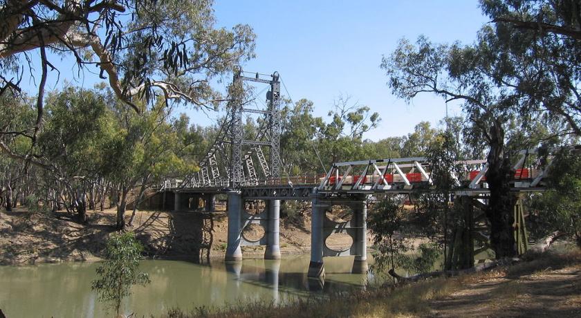
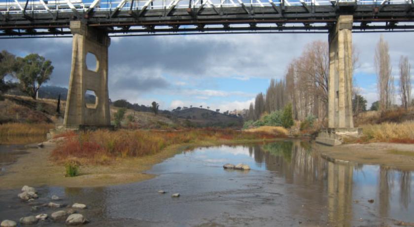
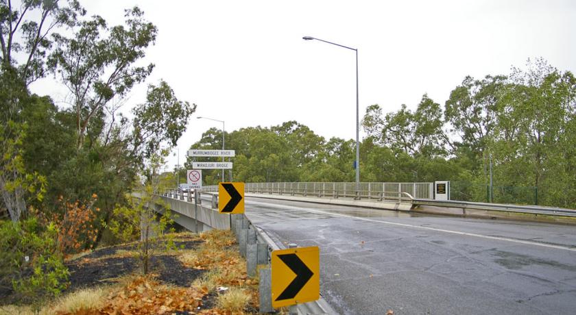
River crossings
The list below notes past and present bridges that cross over the Murrumbidgee River. There were numerous other crossings before the bridges were constructed and many of these still exist today.
Downstream from Wagga Wagga
Wagga Wagga to Burrinjuck
Upstream from Burrinjuck
Distances along the river
- Gundagai to Wagga Wagga - 138 km (86 mi)
- Wagga Wagga to Yarragundy - 37 km (23 mi)
- Yarragundy to Yiorkibitto - 77 km (48 mi)
- Yiorkibitto to Grong Grong - 58 km (36 mi)
- Grong Grong to Narrandera - 21 km (13 mi)
- Narrandera to Yanco or Bedithera - 18 km (11 mi)
- Yanco to Yanco Station - 29 km (18 mi)
- Yanco to Gogeldrie - 21 km (13 mi)
- Gogeldrie to Tubbo - 24 km (15 mi)
- Tubbo to Cararburry - 55 km (34 mi)
- Cararbury to Carrathool - 66 km (41 mi)
- Carrathool to Burrabogie - 56 km (35 mi)
- Burrabogie to Illilliwa - 42 km (26 mi)
- Illilliwa to Hay - 22 km (14 mi)
- Hay to Toogambie - 63 km (39 mi)
- Toogambie to Maude - 40 km (25 mi)
- Maude to Lachlan Junction - 71 km (44 mi)
- Lachlan Junction to Balranald - 137 km (85 mi)
- Balranald to Canally - 42 km (26 mi)
- Canally to Weimby, Murray Junction - 61 km (38 mi)
- Total distance from Gundagai to Murrumbidgee Junction - 1,078 km (670 mi)
Source: https://en.wikipedia.org/wiki/Murrumbidgee_River
Address
Wagga Wagga
Australia
Lat: -35.578552246 - Lng: 148.592788696

