
Description
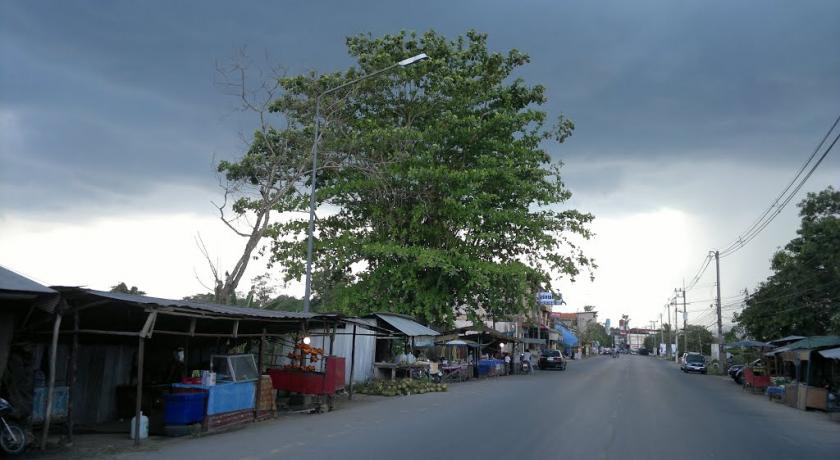
Yala (Thai: ÓĖóÓĖ░ÓĖźÓĖ▓) is the southernmost province (Changwat) of Thailand. Neighboring provinces are (from northwest clockwise) Songkhla, Pattani and Narathiwat. Yala is the only landlocked province in the south of Thailand and its southern part borders Kedah and Perak of Malaysia.
History
Historically, Pattani Province was the centre of the Sultanate of Patani, a semi-independent Malay kingdom that paid tribute to the Thai kingdoms of Sukhothai and Ayutthaya. After Ayutthaya fell under Burmese control in 1767, the Sultanate of Patani gained full independence, but under King Rama I (reigned from 1782 to 1809), the area was again placed under Siam's control in 1785 and made a Mueang. In 1808, the Mueang Pattani was split into seven smaller Mueang including Yala.
The province was recognized as part of Siam by the Anglo-Siamese Treaty of 1909, negotiated with the British Empire, while Siam surendered its claims to Kelantan, Kedah, Terengganu and Perlis. There is a small separatist movement in Yala, which after being dormant for many years, emerged again in 2004 and has recently become increasingly violent. Eight bombs exploded in the province over two days, on 6 and 7 April 2014. The bombings resulted in one death and 28 injuries, as well as damage to a warehouse estimated at about THB100 million. Local officials accordingly tightened security in the province during the Songkranfestivities scheduled for 13 to 15 April.The British Foreign and Commonwealth Office (FCO) in 2014 advised its citizens to only undertake essential travel in the province, while the Australian Government's Department of Foreign Affairs and Trade recommends that travellers completely avoid the province.
Attractions
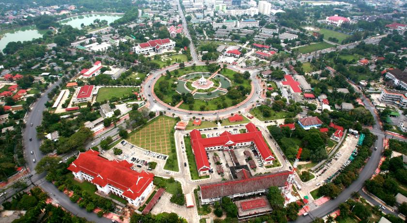
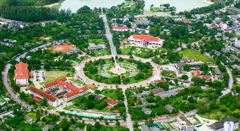
City Pillar Shrine (ÓĖ©ÓĖ▓ÓĖźÓĖ½ÓĖźÓĖ▒ÓĖüÓ╣ĆÓĖĪÓĖĘÓĖŁÓĖć): This shrine houses the City Pillar made of Chaiyapruk wood. It is 50 centimetres tall, bottom circumference is 43 inches, top circumference is 36 inches with the four-faced Brahma and a flame on top.
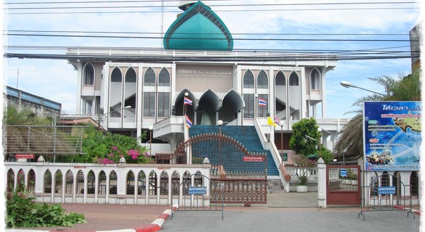
Yala Central Mosque (ÓĖĪÓĖ▒ÓĖ¬ÓĖóÓĖ┤ÓĖöÓĖüÓĖźÓĖ▓ÓĖćÓĖłÓĖ▒ÓĖćÓĖ½ÓĖ¦ÓĖ▒ÓĖöÓĖóÓĖ░ÓĖźÓĖ▓): is the main mosque of the province in Western architectural style intertwined with the unique mosque frame. The front has about 30 wide steps leading to the upper terrace.
Sanam Chang Phueak Park (ÓĖ¬ÓĖ¦ÓĖÖÓĖ¬ÓĖ▓ÓĖśÓĖ▓ÓĖŻÓĖōÓĖ░ÓĖ¬ÓĖÖÓĖ▓ÓĖĪÓĖŖÓ╣ēÓĖ▓ÓĖćÓ╣ĆÓĖ£ÓĖĘÓĖŁÓĖü): Used as the ground to give the king a white elephant (chang phueak) named "Phra Sawet Sura Khachathan". The park has a pavilion in the middle of a large pond and various sculptures of animals.
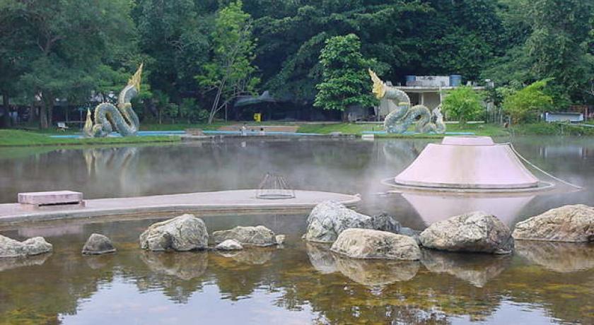
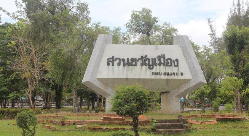
Suan Khwan Mueang (ÓĖ¬ÓĖ¦ÓĖÖÓĖéÓĖ¦ÓĖ▒ÓĖŹÓ╣ĆÓĖĪÓĖĘÓĖŁÓĖć): Its vast area of 207 rai has a separate sports ground and a 69 rai pond, landscaped with sandy beach and sea pines.
Wat Khuhaphimuk or Wat Na Tham (ÓĖ×ÓĖŻÓĖ░ÓĖ×ÓĖĖÓĖŚÓĖśÓ╣äÓĖ¬ÓĖóÓĖ▓ÓĖ¬ÓĖÖÓ╣īÓĖ¦ÓĖ▒ÓĖöÓĖäÓĖ╣ÓĖ½ÓĖ▓ÓĖĀÓĖ┤ÓĖĪÓĖĖÓĖéÓĖ½ÓĖŻÓĖĘÓĖŁÓĖ¦ÓĖ▒ÓĖöÓĖ½ÓĖÖÓ╣ēÓĖ▓ÓĖ¢Ó╣ēÓĖ│): One of the three most-revered places of the south. A figure of a giant, made in B.E. 2484 and named by the villagers as “Chao Khao”, protects the entrance of the cave that houses the reclining Buddha. Inside the cave is a large chamber that has been converted into a religious area.
Tham Mae Nang Montho (ÓĖ¢Ó╣ēÓĖ│Ó╣üÓĖĪÓ╣łÓĖÖÓĖ▓ÓĖćÓĖĪÓĖōÓ╣éÓĖæ): Inside the cave are large connecting chambers that are mostly dark. A torch is highly recommended. The highlight of this place is at the end of the cave with a large stalagmite resembling the shape of a meditating lady, hence the name of the cave.
Tham Sin (ÓĖ¢Ó╣ēÓĖ│ÓĖ©ÓĖ┤ÓĖźÓĖøÓ╣ī): This is a very small and dark cave with an ancient mural of different postures of the Lord Buddha and a painting of three women standing together on the cave wall that has deteriorated with time. A torch or a lamp is highly recommended to view the mural and the cave itself.
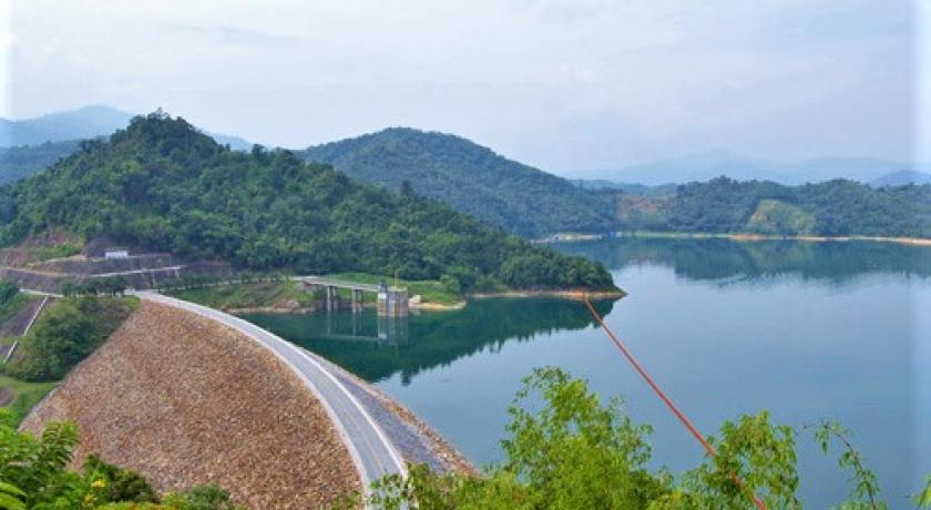
Bang Lang Dam (Ó╣ĆÓĖéÓĖĘÓ╣łÓĖŁÓĖÖÓĖÜÓĖ▓ÓĖćÓĖźÓĖ▓ÓĖć): This dam is the first multi-purpose dam in the south, on the Pattani River. It is 85 metres high with a crest of 422 metres long, and a capacity of 1,420 million cubic metres.
Tham Krachaeng (ÓĖ¢Ó╣ēÓĖ│ÓĖüÓĖŻÓĖ░Ó╣üÓĖŖÓĖć): A cave at Ban Ka Sot, Tambon Bannang Sata, about 50 kilometres from Amphoe Mueang Yala.
Namtok Sukthalai or Namtok Kue Long (ÓĖÖÓ╣ēÓĖ│ÓĖĢÓĖüÓĖ¬ÓĖĖÓĖéÓĖŚÓĖ▓ÓĖźÓĖ▒ÓĖóÓĖ½ÓĖŻÓĖĘÓĖŁÓĖÖÓ╣ēÓĖ│ÓĖĢÓĖüÓĖüÓĖĘÓĖŁÓĖźÓĖŁÓĖć): It consists of five levels. The princess mother named it “Namtok Sukthalai”.
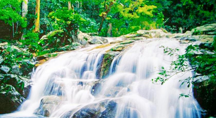
Namtok Than To (ÓĖÖÓ╣ēÓĖ│ÓĖĢÓĖüÓĖśÓĖ▓ÓĖŻÓ╣éÓĖĢ): A large waterfall with cascading water running through seven levels with pools for swimming. The surrounding forest is lush with many interesting species including Si Yala (Saraca thaipingensis Cantley ex Prain) with yellow blooms in February.
Namtok La-ong Rung (Rainbow Waterfall) (ÓĖÖÓ╣ēÓĖ│ÓĖĢÓĖüÓĖźÓĖ░ÓĖŁÓĖŁÓĖćÓĖŻÓĖĖÓ╣ēÓĖć): A slippery trek that leads along the stream from the waterfall. During the rainy season, the waterfall has the effect of the rainbow, hence the name.
Sakai Village (ÓĖ½ÓĖĪÓĖ╣Ó╣łÓĖÜÓ╣ēÓĖ▓ÓĖÖÓĖŗÓĖ▓Ó╣äÓĖü): The Sakai are an ancient nomadic tribe which existed on hunting and gathering, expert in herbal plants and using darts for hunting. Recently the Department of Social Work has developed the village by segregating the Sakai in one area and introduced rubber planting as their occupation.
Namtok Bu Ke Pilo or Namtok Tawan Ratsami (ÓĖÖÓ╣ēÓĖ│ÓĖĢÓĖüÓĖÜÓĖ╣Ó╣ĆÓĖüÓ╣ŖÓĖ░ÓĖøÓĖ┤Ó╣éÓĖźÓĖ½ÓĖŻÓĖĘÓĖŁÓĖÖÓ╣ēÓĖ│ÓĖĢÓĖüÓĖĢÓĖ░ÓĖ¦ÓĖ▒ÓĖÖÓĖŻÓĖ▒ÓĖ©ÓĖĪÓĖĄ): About 19 kilometres (12 mi) from Amphoe Mueang, the entrance to the waterfall is about 500 metres (1,600 ft) from the village. When sunlight shines onto the water, the underwater rocks turn yellow.
Betong (Ó╣ĆÓĖÜÓĖĢÓĖć): A Malay word meaning “bamboo”. This district is at the southernmost point of Thailand. The Betong city centre is surrounded by mountains, resulting in a cool climate and high rainfall, with frequent fog in the morning. It is therefore dubbed “The City in the Fog with Beautiful Flowers”.
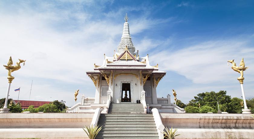
Phra Mahathat Chedi Phra Phutthathammaprakat (ÓĖ×ÓĖŻÓĖ░ÓĖĪÓĖ½ÓĖ▓ÓĖśÓĖ▓ÓĖĢÓĖĖÓ╣ĆÓĖłÓĖöÓĖĄÓĖóÓ╣īÓĖ×ÓĖŻÓĖ░ÓĖ×ÓĖĖÓĖŚÓĖśÓĖśÓĖŻÓĖŻÓĖĪÓĖøÓĖŻÓĖ░ÓĖüÓĖ▓ÓĖ©): This chedi is built in the modern Sivijaya-style, covered in a gold color. It is 39.9 metres (131 ft) high, built to commemorate the 69th birthday anniversary of the queen.
Suan Sut Sayam (Betong Municipality Park) (ÓĖ¬ÓĖ¦ÓĖÖÓĖ¬ÓĖĖÓĖöÓĖ¬ÓĖóÓĖ▓ÓĖĪ): Overlooks the city, consisting of ornamental plants and a flowering plants garden, aviary, health garden, sports ground, swimming pool, and playground.
The Largest Mail Box in Thailand (ÓĖĢÓĖ╣Ó╣ēÓ╣äÓĖøÓĖŻÓĖ®ÓĖōÓĖĄÓĖóÓ╣īÓ╣āÓĖ½ÓĖŹÓ╣łÓĖŚÓĖĄÓ╣łÓĖ¬ÓĖĖÓĖöÓ╣āÓĖÖÓĖøÓĖŻÓĖ░Ó╣ĆÓĖŚÓĖ©Ó╣äÓĖŚÓĖó): Built in B.E. 2467, before World War II, as a communication post for the townspeople, with a radio installed on top of the box and a mail slot below it. A new and larger box was built (9 metres (30 ft) high), and is located at the City Convention Hall (Sala Prachakhom).
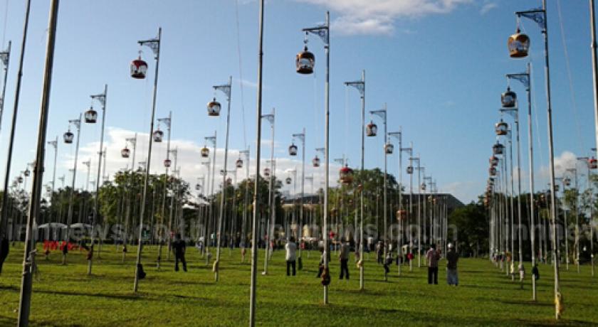
The Swift (ÓĖÖÓĖüÓĖÖÓĖ▓ÓĖćÓ╣üÓĖŁÓ╣łÓĖÖ): At dusk, the swifts fly around the city centre and come to rest on houses, buildings and electricity lines—especially on the Bell Tower that is well lit at night. The birds have become one of Betong's symbols.
Betong Hot Spring (ÓĖÜÓ╣łÓĖŁÓĖÖÓ╣ēÓĖ│ÓĖŻÓ╣ēÓĖŁÓĖÖÓ╣ĆÓĖÜÓĖĢÓĖć): At Ban Charo Parai Village, Tambon Tano Mae Ro, about 5 kilometres (3.1 mi) before the Betong city centre.
Namtok Inthason (ÓĖÖÓ╣ēÓĖ│ÓĖĢÓĖüÓĖŁÓĖ┤ÓĖÖÓĖŚÓĖ¬ÓĖŻ): About 15 kilometres (9.3 mi) from Betong city centre and about 2 kilometres (1.2 mi) from the hot spring.
Piyamit Tunnel (ÓĖŁÓĖĖÓ╣éÓĖĪÓĖćÓĖäÓ╣īÓĖøÓĖ┤ÓĖóÓĖ░ÓĖĪÓĖ┤ÓĖĢÓĖŻ): The tunnel was built in three months in B.E. 2519 and winds through the mountain for about 1 kilometre (0.62 mi)—it is about 50 feet (15 m) wide with several entrances. It was used as the air-raid shelter and food storage area.
Bala-Hala Forest (ÓĖøÓ╣łÓĖ▓ÓĖÜÓĖ▓ÓĖźÓĖ▓-ÓĖ«ÓĖ▓ÓĖźÓĖ▓), or Suan Pa Phra Namaphithai Phak Tai, Section Two (ÓĖ¬ÓĖ¦ÓĖÖÓĖøÓ╣łÓĖ▓ÓĖ×ÓĖŻÓĖ░ÓĖÖÓĖ▓ÓĖĀÓĖ┤Ó╣äÓĖśÓĖóÓĖĀÓĖ▓ÓĖäÓ╣āÓĖĢÓ╣ē ÓĖ¬Ó╣łÓĖ¦ÓĖÖÓĖŚÓĖĄÓ╣ł 2): A lush rainforest with many rare plants and wildlife—especially birds. Also the home of the Sakai tribe, this forest occupies a large area at the boundary of Yala and Narathiwat.
Namtok Chaloem Phra Kiat Ro Kao (ÓĖÖÓ╣ēÓĖ│ÓĖĢÓĖüÓ╣ĆÓĖēÓĖźÓĖ┤ÓĖĪÓĖ×ÓĖŻÓĖ░Ó╣ĆÓĖüÓĖĄÓĖóÓĖŻÓĖĢÓĖ┤ ÓĖŻ.9): In Tambon Ai Yoe Weng, the waterfall is more than 30 metres (98 ft) high and is surrounded by lush forest.
Source https://en.wikipedia.org/wiki/Yala_Province
Address
Yala
Thailand
Lat: 6.541147232 - Lng: 101.280395508

