
Description
Nong Khai (Thai: หนองคาย) is the northernmost of the northeastern (Isan) provinces (Changwat) of Thailand.
History
Over the centuries the control of the province swung between the Thai Kingdom Ayutthaya, and the Laotian kingdom Lan Xang, as their respective powers ebbed and flowed in the region. See also the Haw wars.
Attractions
Prap Ho Monument (อนุสาวรีย์ปราบฮ่อ) The cremated bones of those who lost their lives in the suppression of the Ho in 1886 have been contained inside the monument to honour the good deeds of those who sacrificed their lives for the nation. There are inscriptions in Chinese, English, Laotian, and Thai on all four directions of the monument.
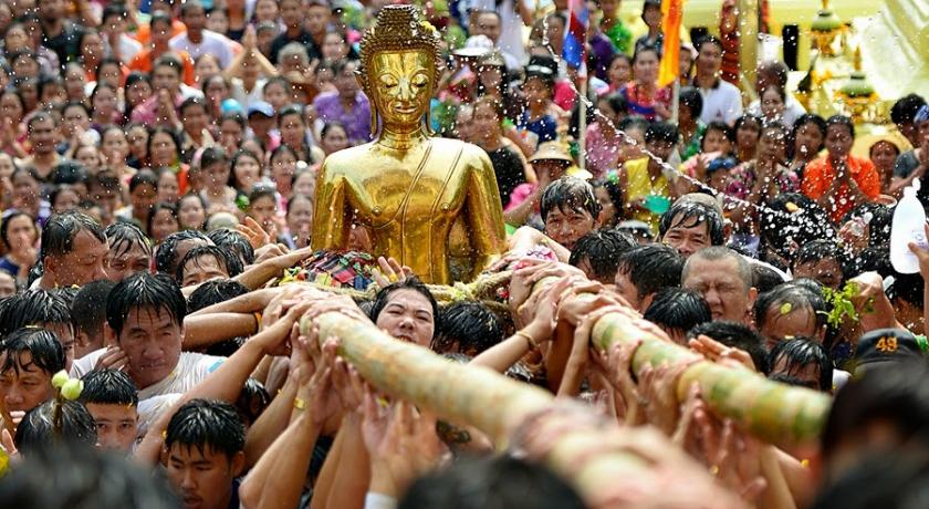
Wat Pho Chai (วัดโพธิ์ชัย) Luangpho Phra Sai, a sacred Buddha image of the town which is respected by the people of Nong Khai, is housed here. Every year on the full moon day in the seventh lunar month, the people of Nong Khai always hold a rocket merit-making fair or Bun Bang Fai to worship Phra Sai at Wat Pho Chai.
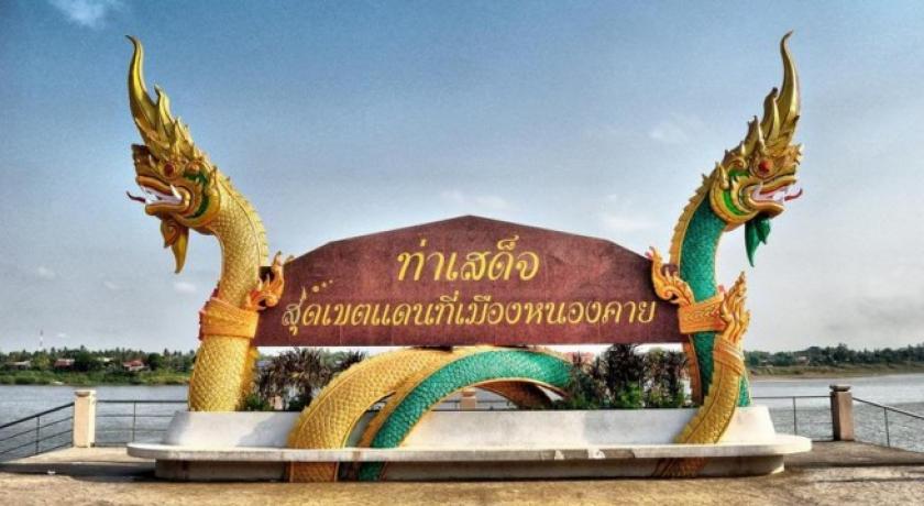
Tha Sadet Market (ตลาดท่าเสด็จ) This is a source of products from Indochina and Eastern Europe, including dried food, processed food, electric appliances, clothes, watches, and kitchenware.
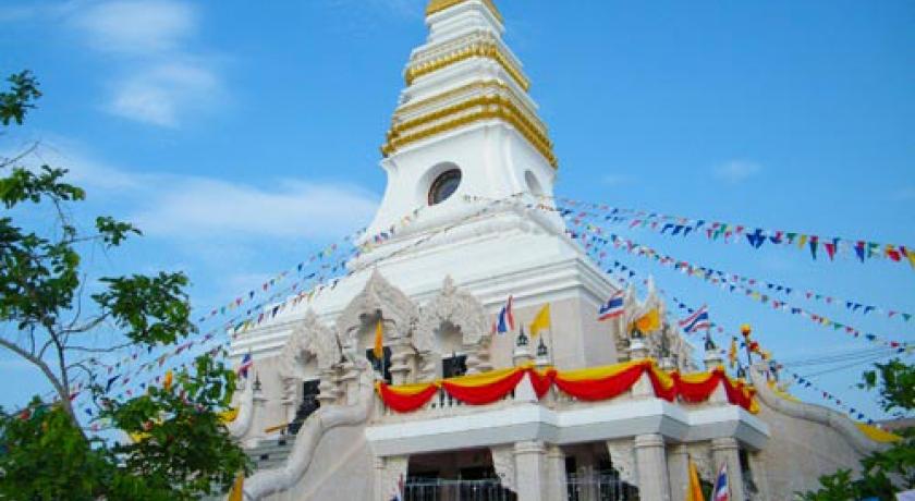
Phrathat Nong Khai or Phrathat Klang Nam (พระธาตุหนองคาย หรือ พระธาตุกลางน้ำ) is a broken pagoda in the middle of the Mekong River. According to the legend of Urangkhathat (Phrathat Phanom), nine pieces of Buddha's foot were kept here. It was presumed that the pagoda was built around the 15th–17th centuries.
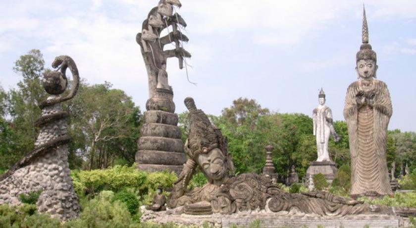
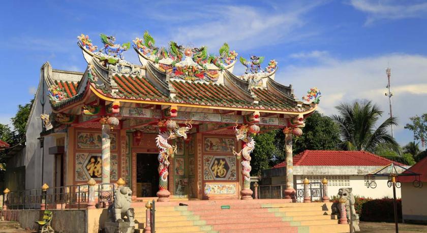
Sala Kaeo Ku or Wat Khaek (ศาลาแก้วกู่ หรือ วัดแขก) This place which looks like an open museum of religious statues was created with an inspiration of Luangpu Bunluea Surirat who built it around 1978, out of his own belief that the teachings of all regions could be mixed together. Therefore, there are Buddha images in different attitudes.
Hat Chom Mani or Chom Mani Beach (หาดจอมมณี) A sandy beach stretching about 200 m and only emerging during the dry season.
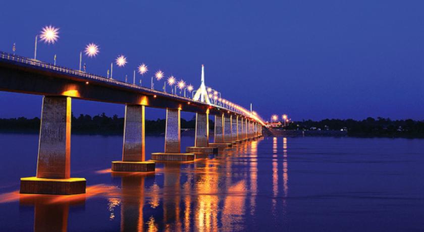
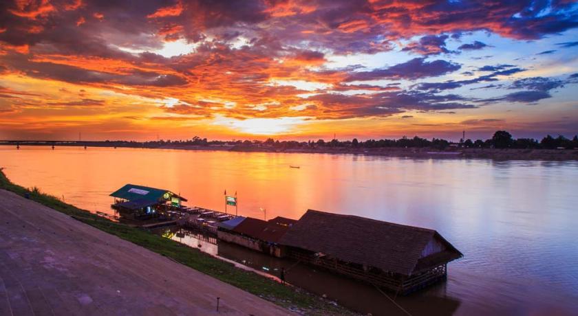
Thai – Lao Friendship Bridge (สะพานมิตรภาพไทย-ลาว) A link over the Mekong River between Amphoe Mueang Nong Khai of Thailand and Tha Duea of the Lao People’s Democratic Republic.
Phrathat Bang Phuan (พระธาตุบังพวน) Within the temple compound, there are interesting ancient places such as Sattamahasathan or the seven important places in the history of Buddha after his enlightenment, and Sa Pappharanak or Sa Phaya Nak (pond of the Naga serpent) where in the past the water was taken to bathe a newly appointed ruler of the town as an auspicious gesture.
Luangpho Phrachao Ong Tue (หลวงพ่อพระเจ้าองค์ตื้อ) This is a large, cast bronze, Buddha image. It is housed in Wat Si Chomphu Ong Tue, Ban Nam Mong. The royal artisans of the northern city and Lan Chang constructed the image over seven years and seven months.
Tobacco-making Village (หมู่บ้านทำยาสูบ) The villagers grow tobacco plantations along the area parallel to the Mekong River.
Freshwater Fishery Village (หมู้บ้านประมงน้ำจืด) The villagers here have freshwater fishery as a profession. Freshwater species of fish raised in their farms are Pla Taphian, Pla Nai, Pla Nuan Chan, Pla Yisok Thet, Pla Klet Ngoen, Pla Hua To, Pla Duk Thet.
Krayo Pastry-making Village (หมู่บ้านทำแผ่นกระยอ) Here, bamboo trays are seen with Krayo pastry being sun-dried along the roadsides. Krayo pastry is used for Vietnamese food such as Popia (spring rolls) and Naem Nueang (wrap of pork and vegetables with spicy sauce).
Phra Sutham Chedi, Wat Aranyabanphot (พระสุธรรมเจดีย์ วัดอรัญญบรรพต) Relics of Buddha are enshrined in this chedi which also serves as a museum. The chedi was constructed by the Electricity Generating Authority of Thailand as a tribute to Luangpu Rian Woralapho.
Wat Hin Mak Peng (วัดหินหมากเป้ง) The temple compound is spacious, clean and shady with various species of plants. Inside the temple, there is a statue of Luangpu Thet on display with the eight requisites and his biography.
Namtok Than Thong (น้ำตกธารทอง) This waterfall has its stream flowing along the rocky ground. Tiers of small cascades line below for a distance of around 30 m before merging with the Mekong River.
Namtok Than Thip (น้ำตกธารทิพย์) is a high waterfall set in lush forest. It has three tiers.
Nong Khai Horticultural Research Centre (ศูนย์วิจัยพืชสวนหนองคาย) There are furrows of local vegetables, such as Krachiao, Phakkat Ya, Som Mong, Phak Wan Pa. Local herbs and more than 100 species of fragrant flowers are gathered here. During the cool season, colourful temperate flowers will be grown as well.
Wat Sawang Arom or Wat Tham Si Thon (วัดสว่างอารมณ์ หรือ วัดถ้ำศรีธน) It is shady with trees and a small stream flows through it. The ubosot (ordination hall) stands on a giant boulder. Down below, a reclining Buddha image is housed for the people to pay homage to.
Phu Thok (ภูทอก) means an isolated mountain in Isan dialect. It consists of two hills: Phu Thok Yai and Phu Thok Noi. Previously, this area was dense woods with many wild animals. Because of its tranquility, Phra Achan Chuan Kunlachettho, a meditation master, initially established a meditation place here for Buddhists to practise Buddha's teachings.
Phu Wua Wildlife Sanctuary (เขตรักษาพันธุ์สัตว์ป่าภูวัว) This sanctuary is around 150–300 m (490–980 ft) above sea level. Types of forest here are mostly deciduous dipterocarp Forest, dry evergreen, and moist evergreen forest. Some parts of the area are sandstone mountain ridges, rocky ground, and grass fields.
Places of Interest:
Namtok Tham Fun (น้ำตกถ้ำฝุ่น) The waterfall is encompassed by a forest with a view of the northern Phu Wua. There is water only in the rainy season.
Namtok Chet Si (น้ำตกเจ็ดสี) The falling water that hits the rocks below causes a spray of water which gives rainbow colours when seen in sunlight. So came the name "Namtok Chet Si", "waterfall of seven colours".
Namtok Phu Tham Phra (น้ำตกภูถ้ำพระ) Like other waterfalls at Phu Wua, it has water only in the rainy season.
Namtok Chanaen (น้ำตกชะแนน) It is 100 m wide and has two tiers with an interval of 300 m. The path to the waterfall passes Khua Hin or a natural stone bridge of around 100 m long.
Address
Nong Khai
Thailand
Lat: 17.879882812 - Lng: 102.739593506

