


Description
Tsing Yi (Chinese: ķØÆĶĪŻ), sometimes referred to as Tsing Yi Island (Chinese: ķØÆĶĪŻÕ│Č), is an island in the urban area of Hong Kong, to the northwest of Hong Kong Islandand south of Tsuen Wan. With an area of 10.69 km², the island has extended drastically by reclamation along almost all its natural shore and the annexation of Nga Ying Chau (ńēÖķĘ╣µ┤▓) and Chau Tsai. Three major bays or harbours, Tsing Yi Lagoon, Mun Tsai Tong and Tsing Yi Bay (ķØÆĶĪŻńüŻ) in the northeast, have been completely reclaimed for new towns.
The island generally is zoned into four quarters: the northeast quarter is a residential area, the southeast quarter is Tsing Yi Town, the southwest holds heavy industry, and the northwest includes a recreation trail, a transportation interchange and some dockyards and ship building industry. The island is in the northwest of Victoria Harbour and part of its coastline is subject to the Protection of the Harbour Ordinance.
Etymology
Tsing Yi (ķØÆĶĪŻ) iterally means "green (or blue) clothes", but is also a kind of fish, probably blackspot tuskfish, once abundant in nearby waters. People named the island after the fish. Tsing Yi Tam (ķØÆĶĪŻµĮŁ, lit. Tsing Yi Pool) or Tsing Yi Tam Shan (ķØÆĶĪŻµĮŁÕ▒▒, lit. Tsing Yi Pool Hill) also appeared on some early Chinese maps.
The island was also known as Chun Fa Lok (µśźĶŖ▒ĶÉĮ) once upon a time, which means the fall of spring flowers, or Chun Fa Island, on some Western maps. Now, Chun Fa Lokis still a place name or a former village on the southeast corner of the island. A government document in the Ming Dynasty named the water near Chun Fa Lok Chun Fa Yeung(µśźĶŖ▒µ┤ŗ). The Ming navy defeated once pirate fleets there.
In some historical sources, Tsing-I Island is used instead of Tsing Yi Island, and Chung-Hue Island instead of Chun Fa Island.
Administration
Tsing Yi Town, together with Kwai Chung Town, is part of Tsuen Wan New Town in the Kwai Tsing District in the New Territories. Although Tsing Yi Island is a de facto outlying island, it is not accordingly included in the Islands District.
Historically, Tsing Yi Island, with Kwai Chung, were usually in the same administration unit as Tsuen Wan because of their proximity and close-knit neighbourhood. Unlike Kwai Chung, however, whose villages are part of Tsuen Wan Rural Committee, Tsing Yi Island has its own, Tsing Yi Rural Committee. The rural committee was politically significant until the establishment of a District Council and Regional Council (now-abolished), and even less significant since the urban population grew much larger than the rural population.
Population
There were about 4,000 people on the island when the British took the New Territories around 1898. In the following one hundred years, the population has grown to nearly 50 times this size; the 2001 Census calculating that the population of the island was 193,432 in 55,478 households. In an estimation in 2007, there are about 200,400 people. It is expected to grow to 203,300 in the near future. Most of the population live in Tsing Yi Town.
Nature
The hilly area of the island largely remains intact and is designated as a green belt. In 1997 a once lost endemic plant, Hong Kong croton, was found in the woodland beneath the highest peak, Tsing Yi Peak, on the island.
History
In the early days, the inhabitants on the island were mostly farmers and fishermen. The major population concentrated in the northeast portion of the island. Farmers grew rice, vegetables and pineapples, while fishermen lived in huts connected by plank walkways in the small harbour of Tsing Yi Tong which stretched far back into the island. Many fishermen also lived on their junks and boats all the time, fishing in the nearby waters. Even as late as the 1970s, Tsing Yi Tong resembled Tai O with its characteristic stilt houses and water vehicles. Like many other fishing villages in Hong Kong, the Tsing Yi dwellers worshipped Tin Hau, the goddess of mercy and the sea. A Tin Hau Temple was built on the shore of Tsing Yi Tong. At the birthday of Tin Hau, fishermen of all nearby waters would come to the Temple for celebrations. The temple was white in color and thus people call it Pak Miu (ńÖĮÕ╗¤, lit. White Temple).
From the 1920s onwards, a Chinese company built lime factories on the present site of Greenfield Garden. It is the earliest known industry on the island. The lime industry continued to flourish during the 1950s, and a tanning factory was also founded at the same period. After World War II, other heavy industries moved in as well. In the 1960s, several oil companies moved their oil storage depots onto the island and a Green Island Cement cement plant. CLP later commissioned its 1520MW oil-fired Tsing Yi Power Station in 1969 at Nam Wan due to its proximity to the oil tank farms. Meanwhile, some small shipbuilding companies opened on Tsing Yi, and remain on the north side of the island. In the 1970s, six large-scale companies on the island collectively built the Tsing Yi Bridge to connect Tsing Yi Town and Kwai Chung Town over the Rambler Channel. The bridge was soon transferred to the Hong Kong Government, remaining the sole road connection to the island for more than ten years. Several industrial buildings for light industries were constructed beside the bridge afterward. Several dockyards moved to the west shore of the island at the end of the 1970s.
During the 1950s, Wok Tai Wan on Tsing Yi Island was a paradise for nudists, and hence Tsing Yi was once synonymous with nudism in Hong Kong.
After the establishment of the Tsing Yi Bridge, the Hong Kong government commenced an extensive new town project on the island. Cheung Ching Estate, Cheung Hong Estate and Mayfair Gardens were consequently built in heaps. The vicinity of the Mobil oil storage depot to Mayfair Garden and Cheung Ching Estate once aroused enormous concern for the safety of the residents. Some social workers and residents urged the government to relocate the storage facilities. The government decided to halt the last phase of the Mayfair Garden development scheme. The storage facility remained at the same location until Container Terminal 9 was on the government's agenda.
Later on, the tenor of town development shifted northward. Two fisherman harbours, Tsing Yi Tong and Mun Tsai Tong were reclaimed for residential use. Many fishermen were relocated from their boats parked in the typhoon shelter to the Ching Tao House, a new residential block on land, of Chueng Ching Estate. The land inhabitants were put together into several designated areas so as to re-build their villages. The primary sectors had all died out owing to the drastic town development. Tsing Yi Estate, Cheung On Estate, Cheung Fat Estate, Ching Tai Court and Tsing Yi Garden were built after all reclamations were accomplished. Ching Wah Court was built adjoining to Cheung Hong Estate. At the same time, Tsing Yi Bridge was seriously overburdened and its structure was unable to cope with increasing traffic. There was only a one-way road in each direction on the bridge. Traffic congestion became the burning problem in the community, and subsequently aroused protest. Finally, Tsing Yi North Bridge, a connection to Tsuen Wan Town was built to ease off the congestion, as well as to accommodate the local residential population boom.
Tsing Yi was continually under further development and Greenfield Garden, Serene Garden, Broadview Garden, and Cheung Hang Estate were constructed.
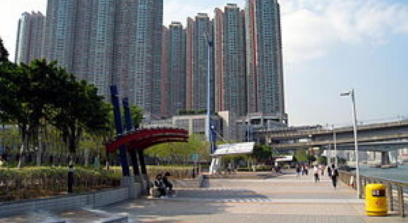
The final decision to relocate Hong Kong International Airport spurred a new series of development: Airport Railway, Ting Kau Bridge to Ting Kau and North New Territories, Tsing Ma Bridge to Ma Wan and Lantau Island, Rambler Channel Bridge to Kowloon and Hong Kong Island, Duplicate Tsing Yi South Bridge on the south side of Tsing Yi Bridge. On the island, new residential projects, Tivoli Garden, Grand Horizon, Mount Haven, Villa Esplanada, Tierra Verde, and Cheung Wang Estate were completed. The final part of reclaimed land near the shore had been laid waste for almost a decade until Tsing Yi Promenade was built in 2004. Local Hong Kong cultural pursuits of Chinese music and dancing, walking and Chinese exercise are in evidence in most evenings.
During 2000 to 2004 Container Terminal 9 was built on the reclaimed southwest shore of the island, together with resident blocks, Rambler Crest. Nearby, and well within sight of Central. Victoria, a controversial new dioxin burning plant was also put into operation during 2004, arousing much concern for the residents of Tsing Yi and Hong Kong island.
Transport
Tsing Yi Island is a transportation hub in Hong Kong.
Address
Tsing Yi
Hong Kong
Lat: 22.347686768 - Lng: 114.110694885

